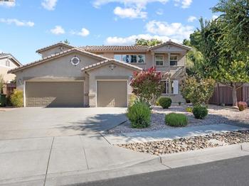
About Brentwood
As you drive past the curve at the corner of Wilshire Blvd. and San Vicente Blvd., you can tell by the row of coral trees lining the parkway that you are in the heart of Brentwood. Brentwood is located at the base of the Santa Monica Mountains, bounded by the San Diego Freeway on the east, Wilshire Boulevard on the south, Santa Monica on the southwest, the border of Topanga State Park on the west and Mulholland Drive along the ridgeline of the mountains on the north.
Nearby neighborhoods and cities include Pacific Palisades on the west, Santa Monica on the south, West Los Angeles and Sawtelle on the southeast, Westwood on the east, Bel-Air on the northeast and Encino on the north.
Brentwood, like nearby Santa Monica, has a temperate climate influenced by marine breezes off the Pacific Ocean. Residents frequently wake to a “marine layer,” a cover of clouds brought in at night which burns off by mid-morning. The topography is generally split into two characters, broadly divided by Sunset Boulevard: the area north of Sunset is defined by ridges and canyons of the Santa Monica Mountains; south of Sunset the area is relatively flat. The southern district features underground springs which bubble up into a small creek along “the Gully” near the Brentwood Country Club, and in the ”Indian Springs” portion of the University High School campus, formerly the site of a Native American Tongva village.
San Vicente Boulevard is considered the “Main Street” of Brentwood and is divided by a wide median on which stand many large and attractively sculpted coral trees. This green belt replaced a derelict Pacific Electric trolley track, its trees evolving into a City of Los Angeles Historic-Cultural Monument. Brentwood boosters have adopted a coral tree silhouette as a de facto community logo. Intersecting Bundy Drive is lined with extremely tall date palms.
History
The area that is now Brentwood was part of the Rancho San Vicente y Santa Monica, a Spanish land-grant ranch sold off in pieces by the Sepulveda family after the Mexican-American War. Development began following the establishment of the large 600-acre Pacific Branch of the National Home for Disabled Soldiers and Sailors in the 1880s. A small community sprung up outside that facility’s west gate, taking on the name ‘Westgate’. Annexed by the City of Los Angelese on June 14, 1916, Westgate’s 49 miles included large parts of what is now the Pacific Palisades and a small portion of today’s Bel-Air. Westgate Avenue is one of the last reminders of the area’s former namesake.
Originally planted with soybeans and avocados, Brentwood is now one of the prominent districts of the Westside and among the wealthiest neighborhoods in all of Los Angeles. It has prosperous commercial districts along each of its major east-west thoroughfares, Wilshire Boulevard, San Vicente Boulevard and Sunset Boulevard, and is largely populated by professionals and executives.
Though there is no direct connection, the name Brentwood harks to Brentwood of Essex, England, a town on the outskirts of London dating back to Saxon times. Many local streets reflect this British heritage, including Barrington, Gorham, and Bristol.
In the early 1920s the Ratteree Brothers bought the area of property now know as Brentwood Glen. There were four Ratteree brothers: Judge Earnest Ratteree, Dr. Ira Ratteree, James Ratteree and Allan Ratteree. They came from the south, spending most of their time in Arkansas and South Carolina before arriving in Los Angeles.
The Ratterees divided their land into five different parcels which at the time was a walnut grove. The land was referred to as the Ratteree Tract. The Ratterees filed for subdivision of the land in the mid 1920s. They named all the streets (and the names are original to this day) but they did not market the property until after the onset of the depression.
The streets and sidewalks were poured in 1927. One of the original Pepper Trees is still in front of 11346 Montana St. In 1932 the first house was built at 11344 Albata Street. It is still the original structure. The majority of the houses were constructed between 1935-42.
In 1954 the city of Los Angeles began construction of three overpasses of the 405 freeway on Ohio Avenue, Sunset Boulevard, and Casiano, now Getty Center Drive.
In 1960 the freeway was completed all the way through the Sepulveda Pass. 1969 was the year the Homeowners’ Association was formed. At that time residents decided to change the name of the neighborhood from the Ratteree Tract to Brentwood Glen. The southbound on-ramp and sound wall were created in 1975-76. After a bus accident in 1994 the Waterford off-ramp was closed. Today Brentwood Glen is home to 560 dwellings consisting mostly of single family homes, with some duplexes, triplexes and multiple-unit apartments.
Local Brentwood traditions include the annual decoration of San Vicente Boulevard’s historic coral trees with holiday lights and a Maypole erected each year on the lawn of the Archer School for Girls, carrying on the tradition set by the Eastern Star Home that was previously housed there. Originally conceived of as a surprise for the women residents at the home, the pole was erected in the dark of night for anonymous neighbors. (Classic film lovers are familiar with this building as the exterior establishing shot for the “Mar Vista Rest Home” that provides a key scene in the 1974 film Chinatown.) Inspired by the community of veterans resident at the former Soldiers and Sailors Home, now a United States Department of Veterans Affairs Medical Center, Brentwood once regularly hosted a Memorial Day parade, complete with a string of classic cars and an elephant named Tiny.
Read More ▾The Commute
Travel Methods
To City CenterAvailable Properties
View all ⇢


Brentwood Sales Data
Percentage change from latest quarter vs same time period previous year
Data compiled using 1st quarter 2019 data vs. same period from 2018
Median Sales Price
MEDIAN SALES PRICE

Demographics
- Filter by:
- Population
- Income
- Education
- Market Rents
Population by Age Level. Median Age 36.9. Households: 18,220.
In Thousand of Dollars. (Median Income: $90,925)
Population by Education Level
Fair Market Rents
Brentwood Schools & Education
Public & Private Institutions Of Learning
Education in the United States is provided by public, private and home schools. State governments set overall educational standards, often mandate standardized tests for K–12 public school systems and supervise, usually through a board of regents, state colleges, and universities. Discover the K12-powered public or private school that is best suited for your child's needs in the area.


 By submitting information, I am providing my express written consent to be contacted by representatives of this website through a live agent, artificial or prerecorded voice, and automated SMS text at my residential or cellular number, dialed manually or by autodialer, by email, and mail.